The Yukon - Wild nature, crazy characters and few roads
Every adventurer's heart beats faster when one just mentions the wild Yukon, the third longest river in North America, which has created myth and cult not only among the First Nations. The Yukon runs like a lifeline through the territory of the same name in northwestern Canada, then flows on to Alaska and finally flows into the Bering Sea. The Yukon region is larger in area than Germany but only has around 43,000 inhabitants (as of 2016 according to wikipedia.de ) and around ten main roads. You notice, that sounds like a lot of wide country and pure nature! It borders Alaska to the west and the Arctic Ocean to the north, is predominantly characterized by boreal coniferous forest and arctic tundra, rich in rivers, lakes and crisscrossed by mountains. Here you can find a variety of animals, from large grizzlies, moose and elks to caribou, badgers, wolverines, smaller deer and also wild horses. Countless species of birds are at home in the many lakes and circle through the air.
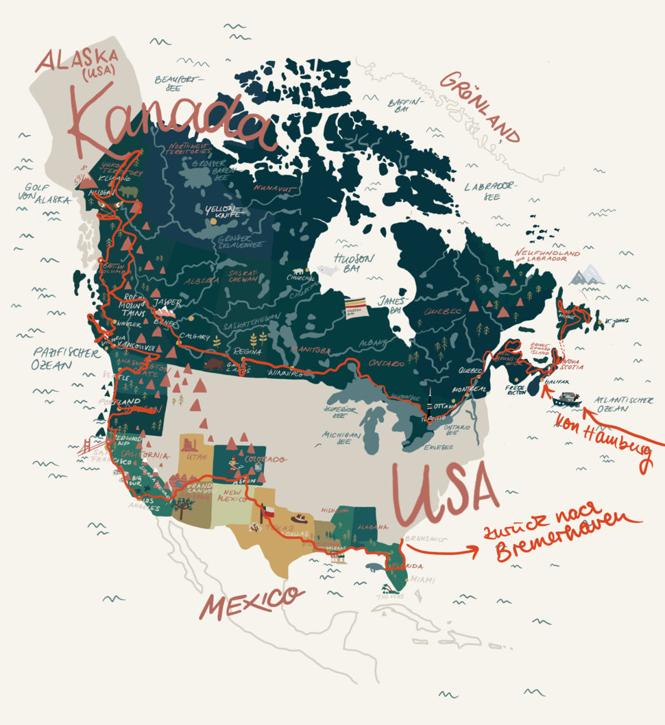
The Yukon is still a very pristine area that is nevertheless open to tourists, even though the Alaska Highway was an original military route and the Klondike Highway is an old gold mining route that used to have completely different reasons for development. We drove along Highways 1, 2 and 4 and were able to explore a large part of the region. From the high mountains in the west to the vast forests in the south and east. We only left out the far north, which is accessible via the 700 km long Dempster Gravel Highway.
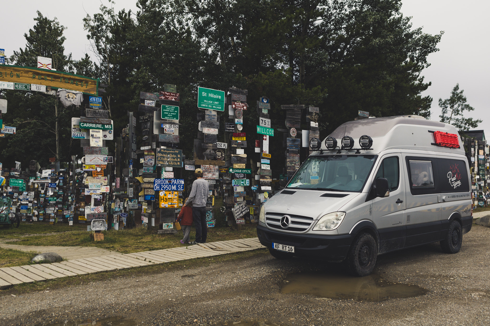
The small southern town of Watson Lake describes itself as the gateway to the Yukon. Which is true, because every mobile traveler passes this point more or less automatically. Here you can replenish your supplies and head further north towards either Highway 4 or Highway 1. Watson Lake itself is known for the “Sign Post Forest”, a “forest” consisting of license plates and traffic signs. But this attraction is worth a stop, the forest of signs is like a journey through the whole world, there are signs from America, Europe and Oceania that were left here by travelers as souvenirs. We too have joined this cult and are now immortalized among the many explorers of the Yukon.
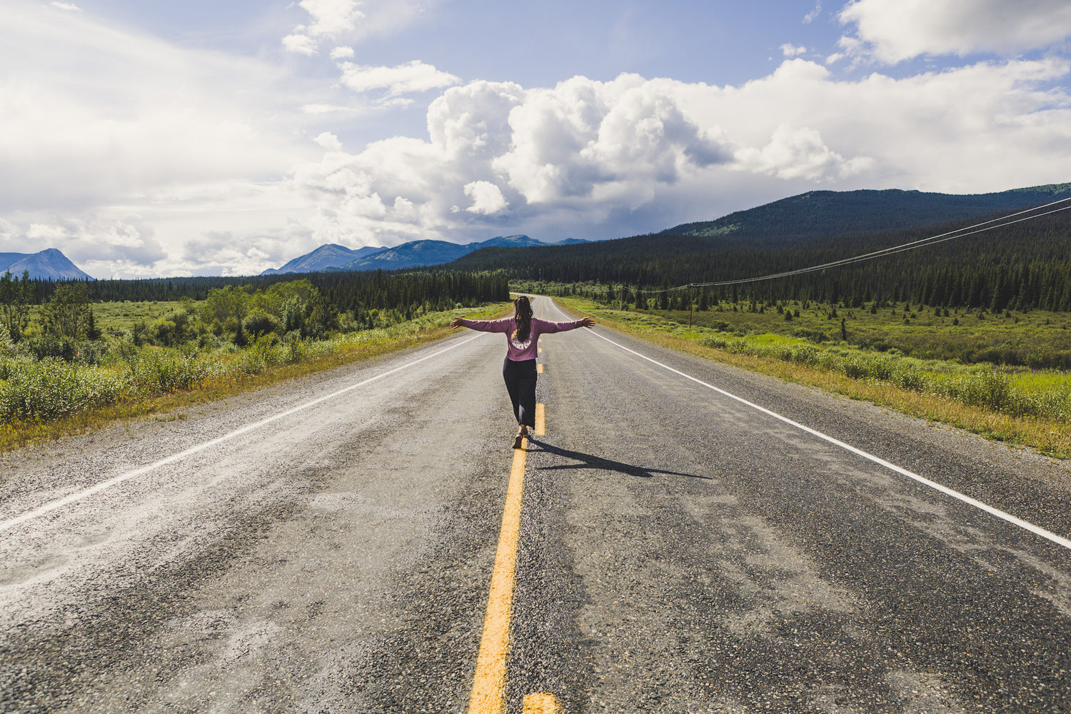
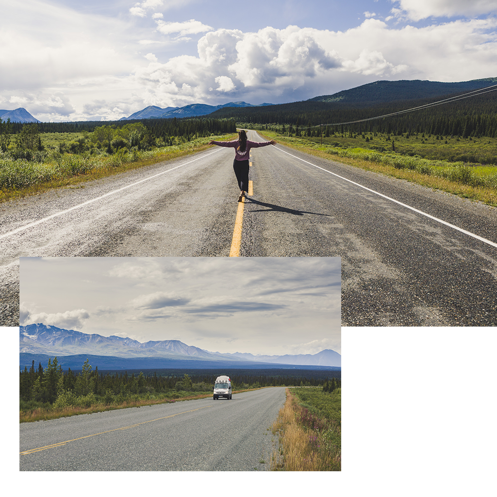
For our way north, we chose the legendary 2,237 km long Alaska Highway (1), which was built in just eight months during World War II from Dawson Creek to Ankorage (Alaska) to ensure supplies for the military in Alaska. Nowadays it is mainly tourists who use the well-developed route through a sensational landscape. You cross raging rivers over old steel bridges, whose banks and islets are strewn with driftwood, and drive along eternal lakes. The road repeatedly climbs hills and offers a spectacular view of the landscape.
After about 400 km you reach Whitehorse, the capital of the Yukon, where the majority of the inhabitants live. There is an airport that has international connections (it can even be reached twice a week from Frankfurt in the summer) and most adventurers set off from here with rental cars or campers, canoes and seaplanes to explore the Yukon. In Whitehorse you will also encounter the legendary Yukon River for the first time, which runs through the city in emerald green.
Our first route took us to a fish ladder on the eastern bank of the Yukon, the longest wooden fish ladder in the world. At the information center there you can watch the fish passing by, mainly salmon in summer, through glass writing. Unfortunately, there are very few salmon on the move this year, which is due to a variety of factors, but is cause for concern as salmon migration is one of the most important ecological events for Canada's fauna and flora. Not only do the animal predators that prey on the salmon live from the salmon, but many plants also absorb the nutrients that end up in the soil when the remains of the carcass decompose. A little disappointed not to have seen any of the 1-1.5 m fish, we walked along the Yukon on a hiking and cycling path towards downtown. The path is a nice and welcome change, because here we can finally walk a little longer and in a relaxed manner with a stroller and children's bike and stretch our legs, because it's not that easy to find suitable hiking trails in the area. Sometimes there are simply no mosquitoes or there are so many mosquitoes that it is absolutely no fun to get out or there is too much bear activity.
The sun was shining, it was mild and finally summery, the first impression of Whitehorse is different than expected. Until now, cities in isolated areas have tended to be practical collections of various necessary shops and supply stations. In contrast, Whitehorse presents itself as a lively, diverse and urban city with restaurants, cafés, exciting shops offering camping and sports equipment and modern museums with attractive architecture. There was a completely different atmosphere and the colorful population mixes well with the travelers who use the city as a starting point and shopping opportunity. We decided to go out for dinner again, a rarity with children, and were surprised to be able to enjoy a pizza at “Dirty Northern” with a really tasty base, crispy edge and truffle-rocket topping (a completely unusual taste for us for weeks).
Unfortunately, the campsite near the city will be closed until 2023 for renovation work, so we set up camp in the RV park on the “Steward Service Road” and stayed here for the next few nights. The RV park is narrow and less attractive than the beautiful campgrounds and parking spaces in the forest of the last few weeks, but it had everything we needed and, above all, a base for us for a few nights to spread out again. Here you will find good washing machines, a small shop and warm showers (without having to press a button every 30 seconds). You can also cycle down the hill to Whitehorse in about 15 minutes (although 30 minutes uphill :-).
There is also a lot for kids to discover in Whitehorse, two huge playgrounds at each end of the city, the Mc Bride Museum, which clearly shows the fauna in the Yukon, the First Nations culture and the gold rush. Unfortunately, the Transport Museum and the Bernina were not open when we visited, but they were warmly recommended to us. The days in Whitehorse passed quickly and will remain in our memories for a long time.

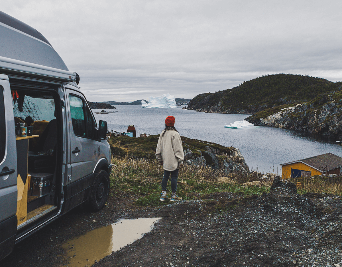
But we head further west, on the Alaska Highway towards Haines Junction and the Kluane National Park there. This forms only a small part of a much larger nature reserve, which extends across British Columbia in the south and Alaska in the west. The glaciers here form the largest ice field south of the Arctic Circle. We first drove to the south of the park to Kathleen Lake and set up camp there, but due to strong winds we only stayed one night and half a day and continued to the northern part to Kluane Lake, the largest lake in the Yukon. We wanted to try out our newly purchased SUP, which we have wanted for a long time and bought in Whitehorse. In Canada, a watercraft definitely makes sense. Since there are few hiking trails in some places, you can find your way on the water.
The route there is even more fantastic than to the south! Always wide views with mountaintops covered in glaciers. Kluane Lake itself is fed by a delta into which the ice masses of a massive glacier melt. A long-distance hiking trail along the delta can be followed to the glacier tongue, unfortunately not for us as the route is not allowed to be traveled by bike due to increased bear activity. The delta dries out more and more as the glaciers recede, revealing its very own, extremely exciting landscape.
Since we unfortunately didn't want to enter the USA and therefore Alaska yet (visa reasons), we drove back towards Whitehorse in order to take the Klondike Highway towards Dawson in the next few days. The beginning of a sensational evening/night, because we were able to observe a lot of wildlife on the road, first a grizzly mother with her two young cubs, which were being chased by her male grizzly, followed by wild horses, elks and some moose and a huge eagle owl with a rabbit's loot in his luggage. We almost felt like we were driving in a fenced-in safari park, but we are on a normal highway and the animals live freely in nature. Above all, observing from the car is a pleasant way, so you don't stress the animals and you can observe their behavior yourself in peace and safety.
After this exciting trip we arrived at Fish Lake near Whitehorse by chance. It was already quite late, around 12:30 a.m., and the routine check of the Aurora app took our breath away for a moment. In the app, the area where northern lights are likely and solar strut activity is high is shown as red and we were in the middle of this red area. The view outwards showed us some gray veiled clouds, but suddenly they began to move in waves, clearly this was untypical for normal clouds. We got our camera and cell phone and the wonderful, typical ones suddenly appeared on the displays Colors of the Northern Lights, lots of green and red and purple in the tips. The intensity increased with every minute and the sky now resembled a single pulsating ghost game 360 degrees around us. The aurora became more and more intense and it became really bright in the night sky; now the green colors were visible, even if only faintly, even without a camera. We were captivated by this natural spectacle, felt almost hallucinated or drunk and still couldn't fully understand our luck that night. Of course we were hoping to see the Northern Lights in the Yukon, but that requires so many factors that rarely come together in August. We watched the dancing lights outdoors for two whole hours at a cold 6 degrees before we were lulled to sleep inside and from the roof hatch, frozen.
After this eventful night, the next day started rather calmly. Luckily for us, the children had already adapted to the rhythm of the setting sun and went to bed late, but also slept quite late (currently mostly until 9 a.m.). We took advantage of the proximity to Whitehorse to restock all our supplies, fill up on water and then headed further north along the Klondike Highway towards Dawson City.
The Klondike Highway, a relic from gold rush times, was the connection to the rich gold fields on the Klondike River in Dawson City. Today it is one of the two roads to the north, is paved throughout and in the first section leads through a varied landscape of lakes, mountains and forests. The vastness of the north was shown to us on this route, because apart from a few lonely gas station villages, there are hardly any settlements worth mentioning between Whitehorse and Dawson. We made good progress, the Yukon River accompanied us again from Carmarks and relatively soon we came to the Five Finger Rappits, a narrow passage with five rocks through which the paddle steamers once had to navigate with difficulty. After several construction sites, we finally reached the gold mining town of Dawson City, where the surface changes to gravel and you walk through a historic museum town on wooden plank paths, just like the gold miners did 100 years ago.
Dawson City was created during the gold rush, and what was initially a small tent settlement soon became a northern metropolis thanks to the 40,000 settlers who arrived. Half of those who arrived were looking for gold, while the other half, the smarter ones, tended to take care of the work involved in supplying the gold seekers. There was definitely good money to be made in accommodation and equipment, pubs and entertainment. Today, Dawson is of course a tourist magnet for every adventurer who wants to recreate the times of yesteryear, a final destination in the north or an interim destination for those who tackle the Dempster Highway, but also a contact point for dropouts and hippies who find their freedom and solitude here in the north . And it's exactly this colorful mix that you meet on the road or in the campground on the other bank of the Yukon.
 You can explore Dawson on foot from the pitch, so we strolled through the town, walking along the planks past the picturesque facades and getting to know locals who mostly only spend the summers here. Julia, the nice owner of the Wildflower Boutique, invited us straight into the garden for a drink with friends. Everyone, including late hippies, celebrating the fact that the sun was shining. We were recommended to stay next weekend for Discovery Days, Dawson's town festival. We stayed, why not? We had no further obligations and we felt comfortable in the small community. Of course, we couldn't leave Dawson without trying our luck at Claim 6, the only freely accessible gold panning spot on the El Doradoriver. We didn't find anything apart from the realization of how hard life must have been back then, but the whole river glittered and there are lots of rocks that are beautiful and exciting when you take a closer look.
The day of the city festival was a particularly hot one and we actually expected a little more from the event, especially from the farmers' and artists' market, but also from the highly advertised baseball game, but perhaps it is precisely this simple relaxation that attracts people so fascinating here in Dawson. So we left the city and thus the northernmost point of our journey and headed back towards the south.

The way back via the Top of the World Highway and thus to Alaska would certainly have been exciting, but we don't have an extended tourist visa for the USA and we definitely wanted to make the most of the regular 90 days in the upcoming autumn without perhaps having to stop at the border Mainland to be turned away.
We rarely like to drive roads twice, but on the Klondike Highway, or at least the section to Carmarks, we had no other chance.
After Carmarks we left the already familiar route and turned off to the Robert Campell Highway, a gravel road over almost 500 km and the alternative route back to the Alaska Highway. The road meandered beautifully between mountain ranges, along rivers and lakes and of course through lots of forest. Here we drove the longest stage back to Watson Lake, about 360 km, without any settlements, gas stations or other supply options. There was also no cell phone reception here, so if the worst came to the worst, you were on your own. We had previously checked our spare wheel and the necessary tools, but we still didn't want to stay stranded. The slope was easy to ski and we made surprisingly quick progress. There are a few simple campsites along the route, but there are only a few opportunities to leave the road or park, we didn't see a single hiking trail, so you should look for accommodation for the night early or head to one of the campgrounds. We spent the night at Simpson Lake, another wonderfully beautiful lake with a government campground, although unintentionally because we would have liked to go to a place earlier if we hadn't driven through a dying forest fire area. The next morning we went out again with the SUP onto the crystal clear lake and we finished the round in Watson Lake and said goodbye to the Yukon.

Struck by the impressions of the last few weeks, we are grateful for the wonderful time we had in the Yukon. Since we were planning the trip, the Yukon has been one of our dream destinations and we spent the weeks here in Canada thinking for a long time about whether we should really take on the long journey, because the stories of this year's mosquito plague, lots of local forest fires and so on bad weather, had influenced and worried us. But we followed our hearts and were rewarded with nature, wilderness, freedom and, above all, sunshine and hardly any mosquitoes. Once again it has been shown that you should not make your plans dependent on the experiences of others, but rather decide exclusively for yourself.
Bye Yukon, we'll definitely be back. For a canoe tour or dog sled ride.
